Photo credits.
Research photography carries obligations that outlast the fieldwork. This page records who made each image, where it was made, and on what terms it appears here.
The protocol
Every image on this site showing identifiable people is published with the consent of the people pictured, obtained as part of the research relationship rather than as an afterthought.
If you are pictured on this site and would like an image removed or recontextualised, write to joel.correia@colostate.edu and we will act on it.
Copyright & permissions
Every photograph on this site is © Joel E. Correia or the named photographer. All rights reserved. They may not be reproduced, redistributed, or used to train machine-learning models without written permission.
To request permission, write to joel.correia@colostate.edu. Requests from the communities pictured, and from researchers and organisations working alongside them, are welcome and are read in that spirit.
Publication covers shown on the Publications page are the artwork of their respective publishers, reproduced to identify the works cited.
The images
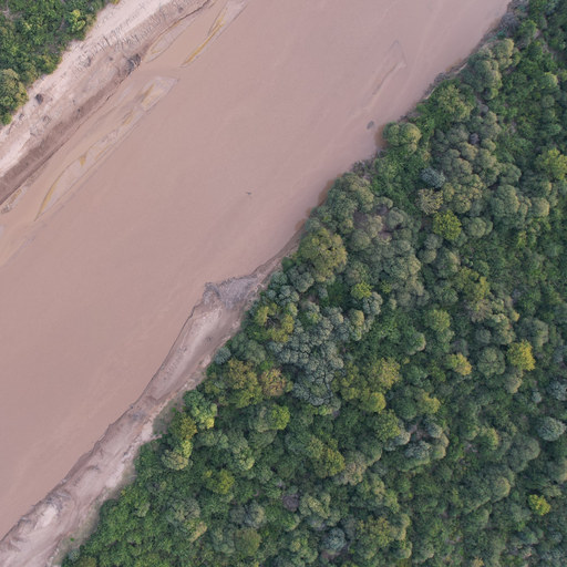
Aerial view looking straight down at a wide, silt-brown river running corner to corner between two walls of forest — the collective's mark.
Place: The Pilcomayo river, on the Paraguay–Argentina border
Photograph: Joel E. Correia
Consent: No identifiable people — the frame is forest and water from about 580m.
Aerial view looking straight down at a wide, silt-brown river running corner to corner between two walls of forest.
Place: The Pilcomayo river, on the Paraguay–Argentina border
Photograph: Joel E. Correia
Consent: No identifiable people — the frame is forest and water from about 580m.
Surveying the "Puente Bioceanica" construction site on the Brazilian side of the border as a boat speeds up the Paraguay River (2023).
Place: Río Paraguay, at the border with Brazil
Photograph: Joel E. Correia
Consent: No identifiable people — the frame is a landscape from altitude; the boat is a speck.
Aerial view looking straight down over unbroken forest canopy — the first frame of the homepage hero footage.
Place: Sucumbíos, Ecuador
Photograph: Joel E. Correia
Consent: No identifiable people.
Aerial view of a braided river running through Amazonian forest toward the Andean foothills, with the FRONTERAS Collective wordmark.
Place: Sinangoe, Ecuadorian Amazon
Photograph: Joel E. Correia
Consent: No identifiable people.
Aerial video looking straight down over unbroken forest canopy, playing muted and looping behind the homepage hero.
Place: Sucumbíos, Ecuador
Photograph: Joel E. Correia
Consent: No identifiable people.
Aerial video following a truck carrying cattle along the Picada 500 at the edge of dry forest, then rising to show the road running straight to the horizon with forest on one side and cleared pasture on the other (video from 2023). Plays muted and looping as the full-bleed band below the research page hero.
Place: Picada 500, Chaco, Paraguay
Photograph: Joel E. Correia
Consent: No identifiable people.
Poster frame for the research page band — the first frame of chaco-road-1600.mp4.
Place: Picada 500, Chaco, Paraguay
Photograph: Joel E. Correia
Consent: No identifiable people.
Aerial view of a frontier: oil palm planted in ranks on one side of a road, freshly cleared ground scattered with felled trunks in the middle, and standing forest on the other side.
Place: Ecuadorian Amazon
Photograph: Joel E. Correia
Consent: No identifiable people.
Karanda'y palms standing singly and in stands across open grassland, under a high sky of broken cloud.
Place: Bajo Chaco, Paraguay
Photograph: Joel E. Correia
Consent: No identifiable people.
Looking up the trunks of two large trees into the forest canopy.
Place: Ecuadorian Amazon
Photograph: Joel E. Correia
Consent: No identifiable people.
A large community assembly seated in the open beneath a spreading tree, with a low building behind and storm clouds overhead.
Place: Kelyenmagategma, Paraguay
Photograph: Joel E. Correia
Consent: Published with the consent of the people pictured.
A motorised dugout canoe pulled up on a cobbled river bank, with forested banks and mountains beyond.
Place: Sinangoe, Ecuador
Photograph: Joel E. Correia
Consent: No identifiable people.
A sign reading “Estamos En Aire” — on the air — mounted on a brick wall, with a piece of tooled leatherwork above it.
Place: Radio Pa'i Puku, Paraguay
Photograph: Joel E. Correia
Consent: No identifiable people.
A gas flare burning at a wellpad cut into standing Amazonian forest.
Place: Ecuadorian Amazon
Photograph: Joel E. Correia
Consent: No identifiable people.
A large community assembly gathered on a forest road, some participants with painted faces and carrying staffs.
Place: Y'apo, Paraguay
Photograph: Joel E. Correia
Consent: Published with the consent of the people pictured.
Heavy machinery grading and paving a new road cut through low forest, with workers at a distance.
Place: Bioceanic highway construction, Boquerón, Paraguay
Photograph: Joel E. Correia
Consent: Published with the consent of the people pictured.
Overhead view of several people around a table working on a large hand-drawn map of rivers and place names.
Place: Siekopai Nation, Ecuador
Photograph: Joel E. Correia
Consent: Published with the consent of the people pictured.
Looking up the trunks of two large trees into the forest canopy.
Place: Ybytyruzú, Paraguay
Photograph: Joel E. Correia
Consent: No identifiable people.
The facade of an old plastered building with an arched doorway, shuttered windows, and a hand-painted ARTESANIA sign.
Place: Concepción, Paraguay
Photograph: Joel E. Correia
Consent: No identifiable people.
A group standing close together outdoors, one person holding a portable transistor radio.
Place: Somewhere deep in the Chaco.
Photograph: Joel E. Correia
Consent: Identifiable people; consent held by the photographer.
Aerial panorama of a cable-stayed bridge under construction across the Río Paraguay, connecting Paraguay and Brazil.
Place: Río Paraguay, at the Puente Bioceánica site on the Paraguay–Brazil border
Photograph: Joel E. Correia
Consent: No identifiable people.
The Aguarico river meandering through Siekopai territories in northern Ecuador.
Place: Aguarico River, Ecuador
Photograph: Joel E. Correia
Consent: No identifiable people.
People seated along a long table in an open-sided wooden building, watching a projected slide of hunting counts and habitat maps.
Place: Siekopai territory, Ecuador
Photograph: Joel E. Correia
Consent: Identifiable people. Consent held by the photographer for publication on this site.
Three piangüa clams half-buried in wet mangrove mud among fallen leaves.
Place: Bahía Malaga, Colombia
Photograph: Paula Cepeda Mahecha
Consent: No identifiable people.
A large group of people walking along a curving beach towards two moored boats, with forested headland behind and rock stacks offshore.
Place: In the islands, India
Photograph: Neha Kohli
Consent: Identifiable people. Consent held by the photographer for publication on this site.
A long roadside mural painting the Bioceanic corridor across Chile, Argentina, Bolivia, Paraguay and Brazil, from the Pacific to the Atlantic, with a marker reading “usted está aquí” beside Loma Plata.
Place: Loma Plata, Paraguay
Photograph: Joel E. Correia
Consent: No identifiable people.
Wordmark reading “Atlas Amazònico” in pale green on a dark green ground.
Place: Not a photograph — a wordmark supplied by Joel on 10 August 2026, padded to 2:1 with its own background colour.
Photograph: None — no credit required, per Joel.
Consent: No identifiable people.
Recent deforestation and land clearing to prepare new cattle pastures.
Place: Boquerón, Paraguay
Photograph: Joel E. Correia
Consent: No identifiable people.
A community event sharing preliminary findings from ecological monitoring with community members.
Place: Sotosiaya, Ecuador
Photograph: Joel E. Correia
Consent: Identifiable people. Consent held by the photographer for publication on this site.
Two dragonflies on a barbwire fence marking the boundary between Sawhoyamaxa lands and a private ranch.
Place: Bajo Chaco, Paraguay
Photograph: Joel E. Correia
Consent: No identifiable people.
Development pressures encroach upon Enxet and Sanapaná territories in the Bajo Chaco.
Place: Xákmok Kásek, Paraguay
Photograph: Joel E. Correia
Consent: No identifiable people.
Preparing yoco.
Place: Banks of the Aguarico River, Ecuador
Photograph: Joel E. Correia
Consent: Identifiable people. Consent held by the photographer for publication on this site.
A forest frontier: where palm production and the forest meet in Sucumbíos Province, Ecuador.
Place: Sucumbíos Province, Ecuador
Photograph: Joel E. Correia
Consent: No identifiable people.
A boundary between the ancestral lands claimed by the Yakye Axa community and where they were dispossessed to the margin of a highway (photograph from 2016).
Place: Yakye Axa, Bajo Chaco, Paraguay
Photograph: Joel E. Correia
Consent: No identifiable people.
Joel E. Correia receiving the 2026 Warner College of Natural Resources Dean's Award for Excellence to an Early Career Faculty Member from Interim Dean Richard Conant.
Place: Lory Student Center, Colorado State University
Photograph: Not known; used with permission
Consent: Two identifiable people, both named in the caption: Joel E. Correia and Interim Dean Richard Conant.
Sunset over a forested valley with a town among the trees below a long ridge.
Place: Ecuadorian Amazon
Photograph: Joel E. Correia
Consent: No identifiable people.
Eleven people at the front of a lecture room after a panel session at the 2026 POLLEN conference.
Place: Barcelona, Spain
Photograph: Taken on a camera timer
Consent: Eleven identifiable people, none of them named in the caption or alt text.
A panel session in progress at the 2026 POLLEN conference, one panelist speaking.
Place: Barcelona, Spain
Photograph: Joel E. Correia
Consent: Four identifiable panelists and audience members seen from behind. Nobody is named.
Banner for the 2026 Global Environmental Justice Conference, 13–14 April 2026, hosted by the Center for Environmental Justice at Colorado State University.
Place: Not applicable — a designed graphic
Photograph: Center for Environmental Justice, Colorado State University
Consent: No people pictured.
Programme for day one of the Simposio de Sociología 2026, “Sociología en el umbral de una nueva era”, held 20 and 21 August 2026 by the Universidad Nacional de Asunción in San Lorenzo, Paraguay.
Place: Not applicable — a designed document
Photograph: Departamento de Sociología / Facultad de Ciencias Sociales, Universidad Nacional de Asunción
Consent: No people pictured. Four speakers, a moderator and a presenter are named in the printed programme; the post names only the four who took part in the session with Joel, as he wrote them.
Portraits
Portraits of collective members on the Collective page — the director's among them — are published with each person's consent, and are supplied by the people pictured or made during shared fieldwork.
Illustration
The field atlas on the Research page is an original drawing made for this site, projected from public coastline data rather than traced from a map.